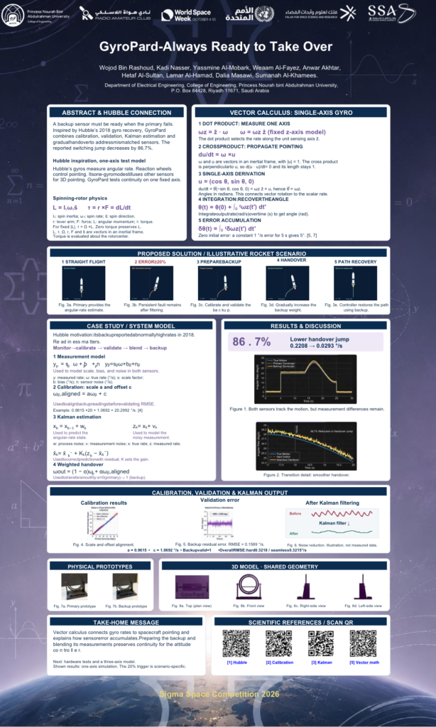
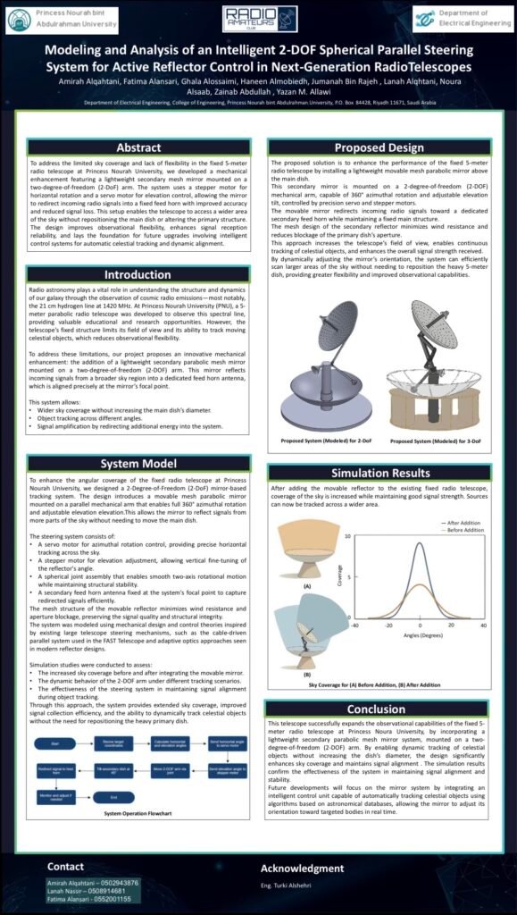
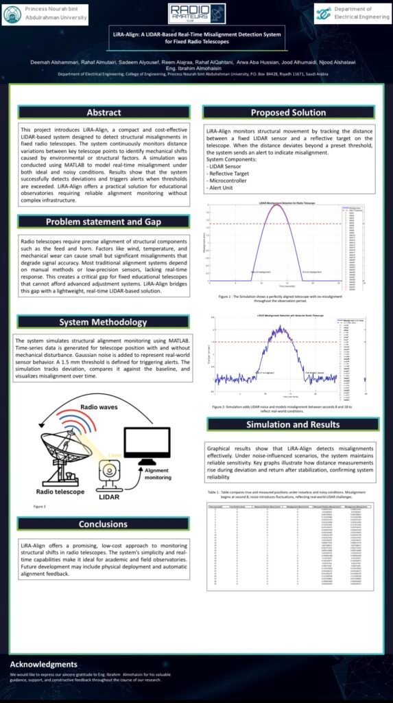
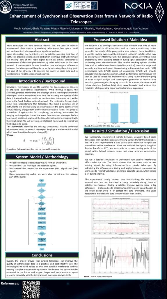
As they move continuously in their orbits, the distance between them keeps changing. How can we determine how long their communication link will remain available? And when might they need to switch to another satellite before the connection is lost?
This is where our project comes in. We use vectors and relative motion to calculate the distance between two satellites, track how it changes over time, and analyze its effect on communication continuity. In this way, we transform mathematical concepts into a model that helps us understand a real challenge in space communication networks
Develop your technical skills
Discover Electrospace
Share your idea
Develop your project
Explore the world of wireless communications
Be part of the tech community
Project Idea
From an Idea to a Communication Experience
01
The Beginning
How Did the Idea Begin?
project began with the observation that satellites continuously move in their orbits, causing the distance between them to change over time. This change may affect communication continuity, especially in space communication networks that rely on data transmission between satellites.
This led to the idea of using vectors and relative motion to study two satellites, calculate the distance between them, and track how it changes over time. The goal is to determine when communication is possible and stable, and when the connection may need to switch to another satellite.
02
The Idea
What Does the Project Offer?
project provides a mathematical model for analyzing the relative distance between two moving satellites. Using vectors, we calculate their relative position and separation distance, then study how this distance changes over time to assess the communication link.
This model helps us understand when communication is available and when satellite motion may require switching the connection to another satellite.
03
The Experience
From Concept to Prototype
Stage 1: Understanding Orbital Motion
We study two satellites moving in different orbits around Earth and determine the position of each satellite using polar coordinates, which depend on the radius and angle. These coordinates help us describe each satellite's position and understand how it moves over time.
Stage 2: Calculating Relative Distance
We use vectors to calculate the relative position between the two satellites by subtracting the position vector of one satellite from that of the other. We then calculate the magnitude of the resulting vector to obtain the distance between the satellites.
Project Team
Raniya Hassan
Milaf Alanazi
Ryoof Almsoud
Ethar Alwassabi
Rooza Alshammari
Ghadi Kilani
Zainab Alalwiat
Project Supervisor
Yazan Allawi
Project Photo Gallery
A visual tour documenting the manufacturing stages, laboratory testing, and live tracking experiments in the field.
Other Projects in This Edition
Explore the projects and experiments that shape the Electrospace experience.